Educational Adventures in Arizona

Friday, May 23, 2008

COMING SOON!

We've been so busy going places that I haven't had a chance to upload any new entries in a while!

Check back soon for the following:

Arizona State Capitol Museum
Agua Fria National Monument
Boyce Thompson Arboretum
Picacho Peak
McCullough-Price House
Desert Botanical Garden
California Mojave Desert
New Mexico White Sands

... and more!

Monday, January 14, 2008

CIVIL WAR DEMO~ January 12, 2008

American Civil War, December 1862: Major General Ambrose Burnside, in command of the Union Army of the Potomac, sent troops to occupy the vicinity of Fredericksburg. General Robert E. Lee reacted by entrenching the Confederate Army of Northern Virginia on the heights behind the town. Burnside originally planned to cross the Rappahannock River 10 miles downstream from the town of Fredericksburg, but Confederate troops arrived there and blocked him. So he decided to cross directly at Fredericksburg. On December 12th, the Federal army went over the river and through the town. Over the next couple of days, Burnside mounted a series of assaults on Prospect Hill and Marye’s Heights which proved futile. Consequently, Burnside called off the offensive on December 15 and retreated across the river, ending the campaign and resulting in a Confederate victory.

Public Domain Image: Battle of Fredericksburg by Kurz and Allison

Several families in our homeschool group stepped back in time to the day when the Union Army attacked the town of Fredericksburg in December 1862. The boys in particular really got into it and had a blast! The Battle of Fredericksburg re-enactment took place at Pioneer Village, Arizona's most historically accurate living history site, with 90 acres located off I-17 just south of Anthem.

Considering all of the unusually rainy weekends we've had lately, we were lucky that it was a beautiful clear winter day. The re-enactors said that it was perfect weather for wearing their wool uniforms - but even so, they still got hot marching out there under the bright desert sun!

We arrived at 9:00 am when the gates opened and that gave us plenty of time to visit the Union soldiers' camp before the fighting began. Both Union and Confederate re-enactors are a great bunch of guys, eager to offer information and answer questions.

A Civil War Encampment, where soldiers slept in canvas tents.

The troops would practice loading their weapons, attaching bayonets, and performing various maneuvers. The boys in our group lined up to drill with the soldiers.

"The first thing in the morning is drill. Then drill, then drill again. Then drill, drill, a little more drill. Then drill, and lastly drill."

Live demonstrations focused on Weapons, Cooking, and Camp Life. The kids rolled paper ammo cartridges, got to hold a gun (the average musket weighs 8-9 pounds), and ate a piece of hardtack (a flour-and-water biscuit, which in those days often became infested with weevils and maggots).

Relaxing around the campfire. When not drilling, standing guard, or faced with the sheer terror of battle, soldiers would spend their spare time reading, writing letters to loved ones, playing cards and other games.

Union troops getting ready for action. It was a great honor to be the flag bearer and when a flag bearer fell in battle, someone else would leap forward to take his place. But their mortality rate was quite high since the goal of the opposing force was to seize the enemies' colors.

The Union Troops Advance Through Fredericksburg!

Confederate citizens either went into hiding, ran away, or prepared to defend their homes and businesses as the Union army invaded their town.

Some of the townspeople got involved in the street fight. (It was an exciting interactive experience for the spectators, too. A gang of boys - mine included! - ran after the Union army, tossing rolled-up newspaper "rocks" at them, but there was so much commotion at the time that I didn't get a picture of that!)

The Confederate troops fall back as the Union army advances. (Newspaper ball "rocks" can be seen on the ground behind them.)

Union soldiers ransacked the town (and got back at the boys who had pelted them with "rocks" by throwing ladies' clothing at them).

Union troops gathering in front of the bank.

Hanging out at the Sheriff's Office.

The Union Army's orders were: "Push a column of a division or more along the Plank and Telegraph roads, with a view to seizing the heights in the rear of the town." In the battle of Marye's Heights, Union troops tried to take the hill, but the Confederates were already entrenched behind a stone wall.

Confederate troops on the march.

Casualties lying in the street.

The Confederates are victorious, and the Union Army retreats. The actual battles lasted from approximately 10:30 - 2:30 with a lunch break in between. We stayed for a while afterwards to wander around and chat with the Confederate soldiers, then left at 3:00 pm although we could have stayed until 5:00.

This event was sponsored by the Arizona Civil War Council, Inc. The Arizona Civil War Council (ACWC) is a non-profit association of volunteer history enthusiasts who re-enact events of the Civil War and Arizona's Territorial Period.

WANTED: ARIZONA VOLUNTEER REENACTORS: No experience is needed and gun NOT required. Instructions will be given on making or buying uniforms, men’s civilian clothes, and costumes for ladies and children. You must be over 16 to use any weapons; under 16 may be drummers, flag bearers, or cannon-assistants IF accompanied by a parent. Dues are about $20/year to cover liability insurance. Visit their website at http://www.arizonacivilwarcouncilinc.com/ for more information.

Did you know...? Gods & Generals (the prequel to the hit movie Gettysburg) showed the Battle of Fredericksburg with its street fighting scenes. In fact, one of the re-enactors on the Confederate side with whom we were talking afterwards explained how he actually played a major role in the movie Gettysburg, as well as Glory.

Additional Info:

http://en.wikipedia.org/wiki/Battle_of_Fredericksburg - Battle of Fredericksburg

http://www.nps.gov/frsp/fire.htm - Fire in the Streets

http://www.nps.gov/frsp/assault.htm - Assault on Marye’s Heights

http://www.nps.gov/archive/gett/soldierlife/cwarmy.htm - What was life as a Civil War soldier like? Get more details in this fascinating article from Gettysburg National Military Park.


Labels: , , , , , ,

Tuesday, December 04, 2007

THANKSGIVING TRIP ~ November 22-25, 2007

I don’t know about you, but the day after Thanksgiving my e-mail inbox was inundated with special sales, deals, and other offers. It seems that everyone was jumping on the “Black Friday” bandwagon. Of course I love a good sale as much as everyone else, but I don’t see why we have to be bombarded all at once over Thanksgiving weekend when most of us would rather be spending time with our families than spending money on retail commodities. Okay, I admit being a little disappointed at having to miss out on some such giveaways because I was busy traveling with my husband and children... but we had great fun on our trip together so I suppose it was a worthy trade-off!

After a big turkey dinner, we brought some leftovers with us and spent Thanksgiving night camping out in the middle of the California desert.

On Friday morning we went to the General Patton Museum.


Later on Friday afternoon and evening we took a look at Hollywood, the Santa Monica Pier, and the Third Street Promenade.

On Saturday we saw the big cloud of smoke from the Malibu fire, but the highlight of the day was getting to meet evangelist and author Ray Comfort who was open-air preaching at Huntington Beach.


On Sunday we drove back to Arizona via Route 66 from San Bernardino to Victorville and through Barstow, Amboy, and Needles.


We had a long distance to go so we didn't have much time to stop and explore along the way, but the area around Amboy in particular was a beautiful scenic (and desolate!) part of the Mohave Desert that I would love to visit again soon.


I hope you are taking an opportunity to enjoy some quality time with your families and loved ones amid the hustle and bustle of the holidays.

Click on this link to read our family newsletter:

http://www.knowledgehouse.info/Xmas%20Letter%202007.pdf

Labels: , , , , , , , , , , , , , , , , , ,

Monday, November 12, 2007

LIFE & TIMES OF LAURA INGALLS WILDER ~ November 10, 2007

This field trip combined lots of fun with learning about history, and it was a gorgeous day – neither too chilly nor too warm, but just right! About 20 kids (ages 4-12) and 14 parents showed up with the Desert Hills CHristian Homeschoolers group. Sharon Cullers, a homeschool mom, was our tour guide. She was assisted by her daughter and daughter-in-law.
First we went to visit the Bank and Sheriff’s Office. The sheriff locked up our lunches in the jail for safekeeping.

Then we got to sit inside the old church and take a group picture on the front steps, and after that we peeked into the teacherage.
Next door, we had “class” in the one-room schoolhouse.

The kids got to sit at the old school desks, while Mrs. Cullers taught us about the life and times of Laura Ingalls Wilder, the author of the Little House on the Prairie book series.

At recess the kids played old-fashioned games – they rolled hoops around, played tug of war, and jumped rope. My son Jon exclaimed, “Wow, who knew that these old games could be so much fun!”

We got to watch a gun fight and pose for a picture with the gunfighters after the show.

After that, we ate a picnic lunch on the village green and learned how to do the Virginia Reel.

Then we went to the blacksmith shop, where the blacksmith showed us how they used to make tools, horseshoes, and nails.
We looked at the Exhibit Hall, and from there we walked over to a large log cabin from the1880's. This is where we made butter, candles, and rope.
Even though we were at Pioneer Village the whole day long (8:30 am to 4:30 pm), the time sure went fast! One girl said “This was the best day of my life!”

Here is an article that I wrote several years ago about Laura Ingalls Wilder: www.knowledgehouse.info/njfklaura.html . It has a recipe for making homemade butter, similar to what we made at the place. Yum! This was the third time that our family has done this field trip and we always enjoy it!

Did You Know…? Whenever school attendance was impossible because of distance or weather, Laura was taught by her mother at home. Later, Laura homeschooled her own daughter Rose.

“I believe it would be much better for everyone if children were given their start in education at home. No one understands a child as well as his mother, and children are so different that they need individual training and study. A teacher with a room full of pupils cannot do this. At home, too, they are in their mother’s care. She can keep them from learning immoral things from other children.” ~Laura Ingalls Wilder

Labels: , , ,

Thursday, October 11, 2007

WINDMILLS ~ September 29, 2007

Don Quixote: Dost not see? A monstrous giant of infamous repute whom I intend to encounter.
Sancho Panza: It's a windmill.
Don Quixote: A giant. Canst thou not see the great arms whirling at his back?
Sancho Panza: A giant?
Don Quixote: Exactly.

An army of windmills!

This wind farm can be seen on I-10 near Indio, CA (in Altamont Pass just east of Hadley's Fruit Orchard). The area contains more than 5,000 wind turbines that look like giant pinwheels spinning in the breeze. It takes 10 minutes to drive through them all!


SAN ONOFRE ~ September 28-29, 2007

San Onofre State Beach.

At low tide you can go way, way out.

Sandstone Bluffs overlooking the beach.

Trail from the bluff-top campground down to the beach.

A train track runs right alongside the campground.

High tide, the next morning.

SAN PEDRO, CA ~ September 27, 2007

Korean Friendship Bell

An old building on the waterfront with rows of gargoyle-like sculptures.

Close-up of creature with a pipe sticking out of its mouth...
What could it be? Anyone have a clue?

San Pedro shipyard and a cargo ship, with
giant cranes to load and unload containers.

Stacks and stacks of China Shipping containers.

A film crew was there doing a movie or something which was pretty cool - we saw a bunch of cameras at various angles, a guy who looked like a director, catering trucks, tents, etc. with security personnel keeping curious onlookers like us away. Note the big black camera on the left, and the camera extended up on the boom at the right behind those three guys.

RANCHO PALOS VERDES, CA ~ September 26, 2007

Point Vicente Lighthouse
Walking between Point Vicente and Long Point

This part of the road is kind of like a roller coaster due to shifting terrain!
It's all uneven and crooked, despite being regularly repaved and realigned.

Wayfarer's Chapel exterior.

Wayfarer's Chapel interior.

This is a beautiful glass chapel surrounded by trees, built in 1951.
It was designed by the son of famous architect Frank Lloyd Wright.
The sanctuary and gardens are open daily for prayer and meditation.

WAY OF THE MASTER ~ September 26, 2007

If you are a fan of The Way of the Master television program hosted by Ray Comfort and actor Kirk Cameron, you should visit their Christian evangelism ministry headquarters in Bellflower, CA (L.A. area). We called ahead to see if we could visit them while we were over there. Most of the crew was in Europe filming the fourth season (13 episodes in 13 different countries in 13 days!), but we got a nice tour of the ministry. They really made us feel welcome and even had a sign in the lobby saying “Welcome Rich Olsen & family from Arizona.” We got to peek inside Ray Comfort’s office and the soundproof studio, among other things.

Bellflower, California headquarters for
Living Waters Publications/Way of the Master Productions

Soundproof Studio where they air The Way of the Master radio show.

Display area in their bookstore.
Ray Comfort has written more than 50 books including The Evidence Bible.
And if you want gospel tracts, boy, do they have a huge selection –
at least 70 different eye-catching tracts and other conversation starters!

CREATION MUSEUM ~ September 25, 2007

The day after we went to Legoland, we visited The Museum of Creation and Earth History in Santee, CA just northeast of San Diego. While there’s been a lot of interest in the AiG Creation Museum in Kentucky since it opened this summer, it’s nice to know that there is a Creation Museum on the west coast for those of us who aren’t able to travel back east. The Museum of Creation and Earth History is operated by the Institute for Creation Research Center founded by Dr. Henry Morris. (This is where Ken Ham used to work before he founded Answers in Genesis.) Exhibits are laid out like a walk through time, explaining the history of the earth and universe according to the Bible beginning with Creation. (This part reminded me of the Adventure walk-through at Legoland!) Other exhibits explain ongoing ICR research in genetics, plate tectonics, radioisotope dating, and weather modeling. Plan to spend 1½-2 hours at this museum with your children, although high school students and adults could stay even longer. Admission is FREE! However, you will probably want to purchase some educational resources in their bookstore to bring home for further study. Visit their website: http://www.icr.org/museum

Wednesday, October 10, 2007

LEGOLAND, CA ~ September 24, 2007

Our family has gone to Legoland just about every year since 1999 when they first opened. My three boys have always been Legomaniacs so they love it. Even my oldest who is now 17 still hasn't grown tired of it. Unfortunately, toddlers will find little to do except ride around in their stroller and look at things. Which is okay since they’ll see something new and colorful around every corner.

The intricate lifelike detail of the Lego models, especially in Miniland, is awesome, even though they’re starting to get a little weather-worn from sitting out in the Southern California sunshine.


While the park is geared toward younger children, most rides have some height requirement, barring the smallest kids from riding. My youngest started being able to go on more of the rides at age 3. Thrill-seeking teenagers will find most of the rides a little ho-hum, but they’ve added a few rides for them, too, like the Technicoaster. Legoland is unique in that they have a lot of interactive stuff that requires actual participation from visitors.


Make sure you’re at the door when they open at 10 am so you will have enough time to see everything, since they close early (5 pm) at this time of year. It’s not as large as other theme parks but it’s just right so you can make it around the whole park without getting too tired out. The little kids rides start on the left when you go in, and the more exciting rides for the older kids are on the right. Just beware of the Hideaway playground near the Knight’s Kingdom because once the kids get in there you won’t be able to get them back out!

The boat ride will take you on a tour past several famous landmarks including Mount Rushmore. Yes, the faces are really made of Lego bricks! And don’t miss the Adventurer’s Club which is hidden away in a corner of Fun Town (adjacent to a gift shop). It’s a really cool (and a little bit scary) walk through a rainforest (with authentic rainstorm sounds and lighting), ancient Egypt (with an earthquake) and the Arctic (watch out for that polar bear!). Adjacent to Miniland they even have a collection of famous artwork made from Legos.

Starry Night

M.C. Escher

The Scream - "Oh no! We have to go now!?"

Did you know that Legoland in Carlsbad, CA offers not just one, but many Homeschool Days throughout the 2007-2008 school year? You're really lucky if you live in the area because then you can go more than once! Legoland’s Homeschool Days include all of the following Mondays: Oct. 1, 8, 15, 22, 29, Nov. 5, 12, 19, 26, Dec. 3, 10, Jan. 7, Feb. 4, Mar. 10, Apr. 14, May 12 and May 19. Homeschool Day is only $17 per person for up to 6 people as compared to the usual $44 child/$53 adult! This is a tremendous savings if you have one or more Lego maniacs in your family. My kids are in the Lego Club and even the coupons they get with their membership couldn’t beat the homeschool price.

The only catch is that to get the discount, you must sign up for their e-mail list at least two weeks in advance of when you want to go. They will send you an e-mail coupon specially coded for your family, so it is non-transferable. Print it out to redeem at the ticket window (you will have to show your valid photo ID). For complete details and to register, go to: www.legoland.com/groups/education/homeschool.htm?csref=_eduinfo. You can also download a Home School Days Resource guide at www.LEGOLAND.com/eduinfo.

Legoland is never crowded when you go on a weekday, even on Homeschool Day. The kids were able to go on a ride and then get right back on again. Just so you know, Legoland parking is $10. And if you need any additional tickets for some reason, the Costco just around the corner on Palomar Airport Road sells Legoland tickets for a few dollars off the regular retail price.

SEE ALSO: www.lego.com/legoland/california for complete info, frequently asked questions, a map, and lots more.

CARLSBAD, CA ~ September 23, 2007


Carlsbad State Beach. Pretty!

Carlsbad State Beach on the weekend.

Carlsbad State Beach on a weekday.

SALTON SEA ~ September 22, 2007


After leaving the dunes, we continued west on Hwy. 78 to Brawley,
quite a nice looking town actually. From there we went north on 111
along the eastern shore of the Salton Sea.
We always see the Salton Sea on the map and finally took the time to drive by it.
We were thinking of camping there but most of the beaches were "closed for the season."
The whole place seemed rather abandoned and it smelled funny besides.
I thought it would be a lot better than that, but I guess it can't compare to the ocean.


So we headed north to Indio and then west over the San Jacinto Mountains. The sun was setting as we went up the switchbacks and hairpin turns on Hwy. 74. (At least they have guardrails!) We were surprised at all the traffic. We thought we'd find a place to camp up on the mountain, but primitive camping spots weren't to be found like they are in Arizona. We ended up paying $10 to stay in the Oak Grove Campground in the Cleveland National Forest. I had thought we'd go through Julian, but driving around the mountains in the dark we ended up somewhere completely different.

Interestingly, the bubonic plague still exists in Arizona, Colorado, and California. So if you don't want to get the "black death," it's best to avoid contact with wild animals like rodents and squirrels, and stay away from prairie dog burrows. No human cases of the disease have been reported since 1996 (2 of the 5 were fatal), but people and their pets can become infected if they are bitten by infected fleas from wild animals and pets that are allowed to roam outdoors.

ALGODONES DUNES ~ September 22, 2007

The sand dunes along I-8 near Yuma are overrun with dune buggies,
but along Hwy. 78 they are beautifully shaped in their natural state.

The above picture of my two youngest boys reminds me of the scene
in Star Wars where C3P0 and R2D2 first landed on Tatooine.
The Star Wars movie was actually filmed near here.

Climbing the dunes at 1:30 in the afternoon -
it was hot with the sun reflecting off the sand!

It wasn't easy climbing up the sand dune mountain but we all made it to the top.
By the time we got back to the car, our shoes were completely full of sand.
The kids couldn't resist rolling around in it, so they ended up with sand in their pockets,
hair, and everywhere. That sand was thick! I wonder how long our tracks stayed there.

ARIZONA TO CALIFORNIA ~ September 22, 2007

A double rainbow is always an amazing sight, and
this one looked even more impressive with the
juxtaposition of a train and Hwy. 60 near Salome.

The same train a little farther down the road just before it
starts curving away from the highway through a little canyon.

We took the back roads south from Blythe on Hwy. 78 through the Palo Verde Valley
and then past the Chocolate Mountains where we saw these Desert Tortoise signs.
This stretch is also known as the Ben Hulse Highway, an important route at one time.
It originally followed an old Indian trail.

The Mesquite Gold Mine, the first open pit gold mine I've seen.
You can take a walking trail up a hill overlooking the pit.
This mine had just resumed operations the week before,
and the VIPs were all there to check out the operations.


Sunday, September 09, 2007

OURAY TO DURANGO ~ September 3, 2007

The most spectacular portion of The San Juan Skyway Scenic Byway (US 550) extends from Ouray to Silverton. The route goes by mountain passes, ghost towns, and canyon walls with waterfalls. It’s a paved two-lane highway but it’s slow-going with many sharp curves, switchbacks, steep grades, no shoulders, and an appalling lack of guardrails.

For the first seven miles south of Ouray, the byway follows the Uncompahgre Gorge. You will be driving along the vertiginous edge of a deep canyon the whole way. The weak-hearted should do themselves a favor and don’t look down to avoid having an extreme panic attack. There are several pullouts for stopping to enjoy the breathtaking views if you dare.

The stretch through the gorge is characterized by steep cliffs with no guardrails, and by the number of hairpin “S” curves used to drop elevation. There is a tunnel to go through, followed by a narrow bridge over Bear Creek Falls, and then the road passes beneath a reinforced concrete snow shed at the deadly Riverside Slide avalanche zone.

After that you will breathe a brief sigh of relief when you leave the gorge and enter a nice flat valley. It was kind of a weird marshy area, though, with steam rising and strong sulphur fumes – you know, the “rotten egg” smell. We weren’t sure if it was the leachings from a nearby mining operation or naturally occurring swamp gas.

Then the road again ascends several switchbacks past the Idarado Gold Mine. The mine tunnels extend beneath the 13,000-ft. mountains a distance of about five miles to the Pandora Mill near Telluride on the other side. (It would take more than 60 miles to get there by highway!) A portion of the trestle bridge is still standing, extending into thin air. A few houses are also still standing, awaiting renovation by the Colorado Historical Society.

Soon the road crosses Red Mountain Pass at 11,018 feet, providing views of Red Mountain and several ghost towns. The last large scale mine was the Standard Metals operation on Red Mountain Pass which continued until late in the 20th century. From there, the highway descends through another steamy, ghostly valley to Silverton.

South of Silverton, the byway goes over Molas Pass (10,970 ft.) and Coal Bank Pass (10,640 ft.), then parallels the Durango & Silverton narrow gauge railroad track before returning to Durango.

Travel Tip: Driving south on the San Juan Skyway Scenic Byway from Ouray to Silverton puts you on the vertiginous outside edge of the highway; driving north from Silverton to Ouray allows you to hug the inside of curves. Between Durango and Silverton it’s just the opposite. Driving north from Durango to Silverton puts you on the outside edge of the highway; driving south from Silverton to Durango allows you to hug the inside of curves. At first I thought the northbound Durango to Silverton route was scary, but it turned out to be pretty tame compared to the southbound highway out of Ouray, which is mile after mile of sheer terror for anyone who has acrophobia. It gives me nightmares just thinking about it!


Labels: , , ,

MONTROSE TO OURAY, CO ~ September 2, 2007

Driving south of Montrose on Hwy. 550 you will pass through Ridgway. The area was made famous as the filming site of the John Wayne western movie "True Grit." We just missed their True Grit Days which was coming up on the second weekend in September. The True Grit Café is full of John Wayne memorabilia. Ridgway is also home to Dennis Weaver and supposedly Ralph Lauren. It’s a beautifully scenic area with green pastures and trees on the edge of the San Juans, with a spectacular view of Mt. Sneffels. The Uncompahgre River runs through the area and they say that wild animals such as deer, elk, and bear are commonly seen in and around town. Ridgway has a state park and reservoir, both of which have trout fishing. We almost thought about stopping and camping near there, but decided to go a little bit farther to Ouray.

The San Juan Skyway Scenic Byway starts at Ridgeway and heads south through the Victorian mining town of Ouray. The area is known as “Little Switzerland” because of its setting at the narrow head of a valley, enclosed on two sides by steep granite towers and dramatic waterfalls. Ouray has a hot springs as well as an ice climbing park. In addition, the town’s motto is “Jeep Trail Capital of the World” and Ouray serves as a hub to the dramatic Engineer Pass, Cinnamon Pass, Imogene Pass, and the infamous Black Bear Pass. Recording artist Bill Fries, a.k.a. C.W. McCall (and Ouray mayor for two terms) wrote a song called “Black Bear Road” based on the phrase, “you don’t have to be crazy to drive this road, but it helps.” Black Bear is a difficult, dangerous trail even for 4WD vehicles and is travelable in only one direction. The road descends over a series of infamous switchbacks. It takes two hours to drive 12 miles.

Originally established by prospectors who arrived in 1875 searching for silver and gold, at one time there were more than 30 active mines in the vicinity. The town was named after Chief Ouray of the Utes, a local Indian tribe. The entire town is registered as a National Historic District with most of the buildings dating back to the late nineteenth century and many of them also listed on the National Register of Historic Places. Ouray is only about 10 miles from the famous Telluride ski resort, but with the mountains in the way it’s a 60-mile drive to get there. Perhaps due to its isolated location, Ouray is friendly and down-to-earth, with none of the pretentiousness of standard tourist towns. A walk down the main street is an authentic old west experience.

The mountains were misty with rain, and Rich and Pete longed for a nice comfortable rest after their climb. So I suggested getting a room for the night rather than camping out. Even here, most of the hotels were all booked for Labor Day. However, this led us to discover the old Western Hotel dating back to 1892. This structure is one of the few remaining examples of a wood frame hotel from the 1880’s.

Wow, talk about authentic! The lobby looks just like it did in its heyday, with stained glass windows and an ornate tin ceiling still adorned with the original lighting fixture. (One of the world’s first to have alternating current.) After checking in at the historic registration desk, you climb up a steep red-carpeted staircase. Once upstairs, you walk down a creaky narrow hallway where there are a dozen or so small rooms featuring antique dressers, brass beds covered with quilts, and lace curtains fluttering in the breeze. The walls are not insulated, and there is no central HVAC system, not even a window unit. The only way to control the temperature is by opening or closing the window. No phones, no TV, no alarm clock, and the bathroom is down the hall. (Well, actually, the ladies' and gents' toilets are down the hall and the BATH – meaning an old-fashioned footed tub – is in its own separate room.)

At least it beat camping out in the cold and it sure was neat to stay in such an old-fashioned place right out of a classic western movie! Five of us slept in a tiny room with two twin brass beds – two of us in each bed and one on the floor, but that kept us nice and cozy. The proprietor (who also operates San Juan Scenic Jeep tours out of the hotel lobby) caters to hikers and jeepers, so he didn’t mind us bringing in a sleeping bag and pad to sleep on the floor.

It’s a family-owned business, too, with two sons (age 10 and 16) helping out in the dining area, mom and dad in the kitchen, and their little girl (age 6) hanging out with grandpa in the lobby. Grandpa was there until late at night and again at 7:00 in the morning, so I wonder if he lives in his own room at the hotel. Adjacent to the hotel lobby is the saloon with its original carved wood bar, historic paintings (one is an enormous western landscape; the other is a nude woman in a classic pose - just so you know!), and the famous “face on the barroom floor.” Check out their website at www.historicwesternhotel.com.

Labels: , , , , , ,

Saturday, September 08, 2007

LAKE CITY TO MONTROSE, CO ~ September 2, 2007

Lake City was named for nearby Lake San Cristobal. There are quite a few smaller lakes and a stream runs through there, too. We saw lots of beaver dams and lodges. The whole area is picturesque and unpopulated. Lake City is a well preserved turn-of-the-century town. It’s one of Colorado’s largest historical districts, with over 75 buildings from the late 1800’s. I would have loved spending some time walking around Lake City’s charming downtown and admiring its quaint Victorian architecture. As one of the most isolated 19th-century Colorado mining camps, Lake City is still a quiet little town in the middle of nowhere, a perfect getaway destination from civilization.

From Lake City we headed north on Hwy. 149 to Blue Mesa Reservoir. Created by Blue Mesa Dam, the 20-mile long fiord-shaped reservoir is Colorado’s largest body of water, with 96 miles of shoreline. The road skirts alongside of it, so we got to see the lake from one end to the other. The most amazing thing was, on this huge lake hardly anyone was there on a beautiful 70º Labor Day weekend! We saw one sailboat and a few other boats, but Arizona lakes are way more crowded than this one! Their facilities include two marinas, three boat launches, and a National Parks Service visitor center with displays. There are hiking trails, too.

The Black Canyon of the Gunnison begins below Blue Mesa Dam. The deepest and most dramatic section of the canyon is preserved as a National Park. The Black Canyon is so steep and narrow that the walls are cloaked in dark shadows because sunlight doesn’t reach them. The Gunnison has one of the steepest river descents in North America, dropping an average of 43 feet per mile, and as much as 240 feet per mile at Chasm View. (In comparison, the Colorado River through the Grand Canyon drops an average of 7.5 feet per mile.) On the north side of the canyon is Painted Wall, the highest sheer cliff in Colorado at 2,250 feet. There is a scenic drive along the south rim, a campground and several miles of hiking and nature trails. The canyon is also popular with rock climbers. It’s not the place to go if you’re scared of heights, however! We didn’t have time to stop there but I shudder just thinking of it!

Cimarron is a small community on the Cimarron River, just south of the Black Canyon of the Gunnison National Park. We passed by the Cimarron Shooting Club, and a place that resembled a Pioneer Village with old buildings to walk around. From there to Montrose it’s wide open prairie for the most part. Montrose is the largest town in the area. Incorporated in 1882, it became an important shipping center with the Denver & Rio Grande railroad as well as a branch railroad line serving the mineral-rich San Juan Mountains to the south.

Montrose has an airport and is gateway to the world-class ski resort Telluride as well as the exclusive Valhalla Shooting Club & Training Center on the grounds of the five-star Elk Mountain Resort. VSC features a 16,000 square foot indoor pistol facility with a state-of-the-art automated shooting range and a two-story 360-degree live fire scenario house. The computer-controlled lighting, sound effects, and props were created with the assistance of Broadway stage designers. Realistic scenario rooms include a subway station, bedrooms, kitchen, bar, nightclub, industrial area, a warehouse, the first class section and cockpit of an airliner, and many other fully furnished settings.

This is a great concept and it’s worth checking out the video on their website at www.valhallatraining.com, but Valhalla is certainly out of our price range. A lifetime membership costs something like $60,000! (Norman Schwarzkopf and Kareem Abdul-Jabbar are members.) It’s open to day visitors, but members and resort guests have priority. If you were to just take a two-day class it would cost around $500 per person. Then they will let you stay at the resort for a special “reduced rate” of only about $300 per night. There is an on-site restaurant, but even that will average $30/plate. Hmm, is it really a progressive one-of-a-kind educational facility or more like a reality-based playground for the rich and famous?

Labels: , , , , , , ,

Friday, September 07, 2007

HANDIES PEAK, CO ~ September 2, 2007

Since we were camping in the American Basin with tall peaks all around, the sun didn't reach us until 8:30 am. It was 41º when we woke up and later it would get to be 64º. At 10:30 some clouds came by and it got colder and windy, but they blew over quickly and then it was warmer again and sunny. It was so was exciting to finally be at our destination! We had talked about this for weeks and imagined what it would be like, and now here we were finally seeing it in person. The trailhead was just up a little ways at the end of the road, but we packed up our tent and drove the rest of the way so that we wouldn't have to walk any farther than we had to.

I had thought we’d all get at least part way up the trail and perhaps some of us would have to turn back after a while. But when it came time to head out, Josh felt sick and Jon didn't feel good either. I was disappointed that I had to stay down with them and wasn't even able to say that I had attempted to reach the top. Even so, I understood because when I was younger I used to get headachy and nauseous just going up to the higher elevation of Flagstaff, which wasn't nearly as high as we were now. Over the years I eventually grew out of it, and I didn't get a headache the whole time we were in Colorado.

I had brought along ginger cookies and ginger candies, but the kid who should have been eating them didn't like the way they tasted. So Josh kept throwing up all morning, until around noon he finally felt better and we walked along the stream to a waterfall. Jon wasn't too bad, perhaps because of the motion sickness wrist bands he was wearing, but he just wanted to stay in the car and snooze. We were parked near the site of an old mine, although all that was left of this one were some tailings.

Even though we had to wait while Rich and Pete were gone for six hours, the time didn't seem that long. I got the car organized, looked at the map, and watched people come and go. A few climbers had gotten there even before us, but the majority of them came between 9:30-10:00 am. A few others didn't start out till the afternoon. Some people just drove up the American Basin road to look at the scenery or have a picnic and then they left again. A bunch of guys in Jeep Wranglers came by at one point and were tossing a Frisbee back and forth. I overheard them say that it didn't glide as good in the thin atmosphere.

It was funny, Rich and Pete departed from the trailhead at 7:30 am. We were still freezing and bundled up. But at the same time, a group of college girls started up the trail and they were all wearing shorts! The girls were already back down at 11:00 but Pete and Rich didn't return until 1:30. I thought maybe the girls hadn't gone all the way to the top of the peak, but Rich rolled his eyes and said that they had indeed been at the top. People who live in Colorado must be in good shape for that sort of thing, at least as far as their lung capacity goes. Even with all of our hill climbing, we were at a disadvantage coming from a low desert elevation.

I could only see Rich and Pete going up the trail for a short distance after they left. From the American Basin trailhead, the trail climbs up the grassy slope of the basin towards a ridge immediately in front of us and then zigzags to the left. After that I had no idea what direction they were in or even which peak was Handies, there were so many peaks around there. Apparently Handies looks more like a rounded ridge anyway.

Along the way to Handies Peak, Rich and Pete passed by Sloan Lake, a beautiful alpine lake. Signs at various intervals remind hikers to stay on the trail to avoid erosion of the fragile tundra. Approximately one and one-half miles from the trailhead and just below Sloan Lake, the trail turned to access a moraine ridge.

Rich and Pete made it to the top of Handies, so I was glad of that because the whole reason why we had come here in the first place was because of Rich's wish to climb a 14,000 foot peak. Rich and Pete thought they were on a false peak until a guy came by and told them that was THE peak. Rich said the trail had swung around so they must have been close up above us but couldn’t see us. It was like being in the middle of a primitive wilderness, because all they could see were mountains for miles around. Fortunately they took lots of pictures so that I could see what they saw.

According to their GPS, the trail was 2.5 miles long each way. The elevation gain was about 2600 ft. They started out at 7:30 am, reached the summit at 11:30 am, and got back down at 1:30 pm. At 14,048 feet, Handies Peak is among five other 14,000 foot peaks in the area (Sunshine Peak, Redcloud Peak, Uncompahgre Peak, Wetterhorn Peak, and Mount Sneffels), as well as numerous high thirteeners. Rich said that the panoramic view from the top looking out over the sea of San Juan summits that surrounded them was incredible.

As soon as the guys got down from the mountain, we wanted to start heading back because it would be a long drive home. However, we were reluctant to return the same way we came, so we decided to continue east to Lake City. From there we would have to drive north, then west, then south to go all the way around the San Juan Mountain range. Even though it would take us 160 miles out of our way, we figured it would be better than getting stuck forever at that one bad spot.

The road to Lake City is supposed to be a 2-wheel drive road, but the stretch just east of American Basin still seemed awfully rough for passenger cars. It’s a really narrow dirt road, and as we got closer to Lake City we were driving along the edge of a cliff – on the outside edge. Then a car came from the other direction and there was no place to pull off and barely enough room to pass. Yikes! If you’re afraid of heights do not go that way! Haven’t the folks in Colorado ever heard of guard rails?

Even the streams and waterfalls in the highly mineralized San Juan Mountains have a silvery appearance.

Additional Information:

http://www.co.blm.gov/gra/gra-american.htm (American Basin trail description and maps, from the Colorado BLM.)

http://14ers.home.comcast.net/redcloud/trip.html (Trip Reports for Redcloud Peak, Sunshine Peak, and Handies Peak.)

http://www.14ers.org/page.php?pname=peaks/sanjuan/handies/standard (Detailed information on the American Basin Route including photos, maps, and elevation profiles.)

http://en.wikipedia.org/wiki/San_Juan_Mountains (An amazing 360° panorama of the southwestern San Juans, photographed from the Gold Hill Ridge of the Telluride Ski Resort. Ridgeline annotation indicates the names and elevations of 43 visible peaks.)


Labels: , , , , ,

LABOR DAY TRIP TO COLORADO ~ September 1, 2007

On Friday night when Rich got home from work, we loaded up the car and took off. Being Labor Day weekend and after a record-breaking month of August with 31 days over 110+ degrees, everyone was heading out of town! The traffic was backed up from Black Canyon City south, which cost us a whole extra hour of driving time.

We went through a few sprinkles when approaching Flagstaff, but it was a beautiful night at our camping spot north of there. We didn’t get to sleep till 11:00 but were already up and breaking camp at 7:00 on Saturday morning. We continued north until we got to Hwy. 160 and headed diagonally across the Navajo Indian Reservation, past the gateway to Monument Valley, and on to Four Corners. This is where the boundaries of New Mexico, Utah, Arizona, and Colorado meet, the only place in the U.S. where four states come together like that.

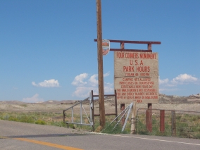
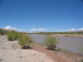
The San Juan River runs through there and that’s where we stopped to have our lunch. We didn’t realize at the time that the water in this river originates in the very San Juan Mountains of Colorado that we were heading for. Since the San Juan is on the western side of the Continental Divide, it flows southwest into New Mexico, past Farmington (where it meets up with its main tributary, the Animas River), northwest into Utah, and west to the Colorado River at Lake Powell near Rainbow Bridge.

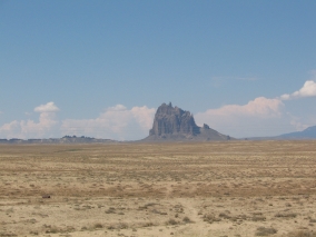
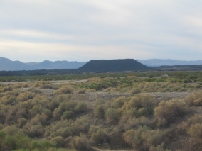
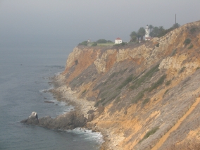
This whole section of the Colorado Plateau is a uniquely scenic area of canyons, red sandstone mesas, buttes, and angular volcanic rocks – including the landmark Ship Rock – rising dramatically 1700 feet above the desert plain.

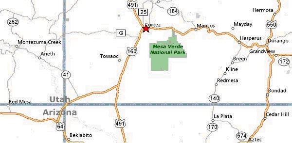
We briefly drove through a tiny corner of New Mexico before entering Colorado on the Ute Mountain Indian Reservation. We saw the roads leading to Hovenweep National Monument, Canyons of the Ancients National Monument, and Mesa Verde National Park. These are all places that I would love to see, maybe someday. Now we know how to get to them, anyway.

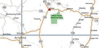
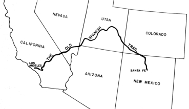
The first town that we came to in Colorado was Cortez. It looked like a nice little farming community. We drove east on Hwy. 160, this portion of which I later found out was The Old Spanish Trail, first used by Juan Maria de Rivera in 1765 and named by John C. Frémont in 1844. The Old Spanish Trail went from Santa Fe to Los Angeles, but strangely enough it bypassed Arizona – going through Colorado, Utah, and across the southern tip of Nevada instead.

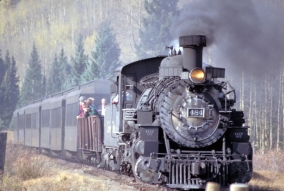
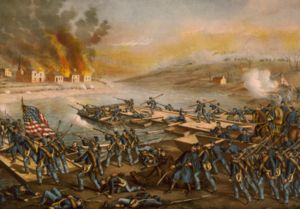
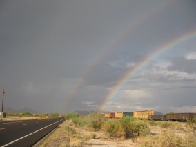
We headed into the mountain foothills and briefly ran through a rain storm. About an hour later we came to Durango, a college town and resort area that reminded me of Flagstaff, AZ. Durango is located in the pretty Animas River Valley. The Durango and Silverton Narrow Gauge Railroad runs along Animas Canyon between Durango and the mining town of Silverton, Colorado. We never saw the historic steam train, but here is a public domain photo of it:

Just like Flagstaff, the area around Durango is an outdoor lovers paradise – whether it’s visiting ghost towns, wilderness trekking, rock climbing, mountain biking, hiking, hunting, fishing, canoeing, rafting, kayaking, and off-roading. Jeeps are more common than ATVs here – they can be seen everywhere! Jeeping is popular on the primitive trails between all of the historic mining camps.

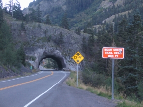
From Durango we drove north on Hwy. 550, a.k.a. The San Juan Skyway Scenic Byway. About 30 minutes north of downtown Durango is the Durango Mountain Resort at Purgatory, which is a small ski area. Despite all the snow, the San Juan Mountains are so steep that the only other ski resort in the area is Telluride, unless you count the cutting-edge Silverton Mountain extreme ski area. It is the highest ski area in North America with the longest drop, and it is also the steepest with no easy way down and requiring all skiers to carry their own avalanche rescue equipment.
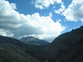
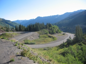
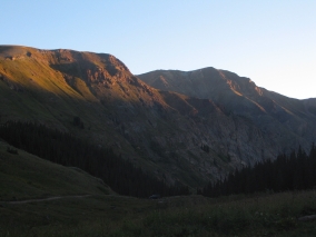
The road from 
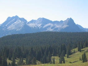
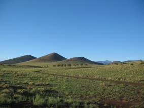
Durango to Silverton goes through alpine meadows, winds around mountainsides, and rises over high passes until it finally reaches the small frontier town of 
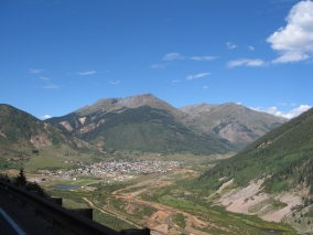
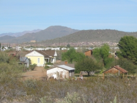
Silverton, a former silver mining camp nestled in a mountain valley surrounded by beautiful peaks. The last large mine closed in 1991. Silverton is now a federally designated National Historic District and tourist destination. At 9,318 feet above sea level, Silverton is also one of the highest towns in the U.S.

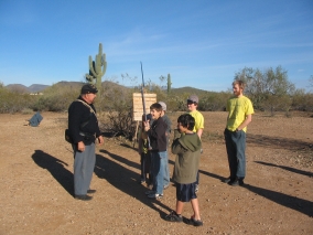
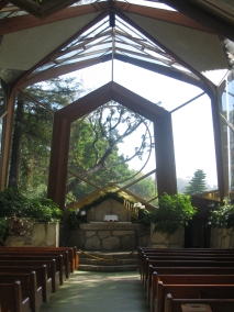
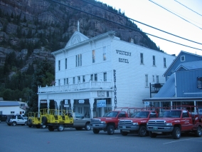
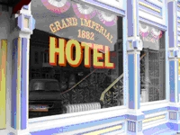
The Silverton Visitor Center is located in a nice old Victorian house painted light yellow. It’s situated in a community park with playground equipment, green grass, and even a paved running track. This was a great stop for the boys after being stuck in the car for hours! Following our time at the visitor center, we ate an early dinner in the historic Gold King Dining Room & Saloon adjacent to the Grand Imperial Hotel (established in 1882) on Silverton’s main street.

The Gold King Dining Room is a fun, family-friendly, smoke-free restaurant (no one was even sitting at the bar when we were there) and they have great food at reasonable prices, too. In addition to the menu items, they offer a weekend Mexican buffet and breakfast buffet, too. The décor includes a moose head, bison head, deer head, stuffed bobcat, and other assorted items of interest for kids to look at. Supposedly, Silverton's Sheriff Bat Masterson left a bullet hole in the ornately carved wooden bar while chasing an outlaw gang.

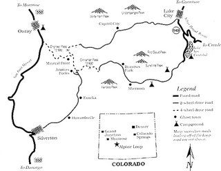
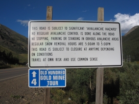
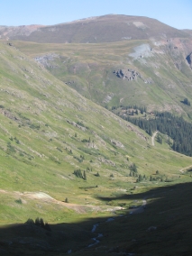
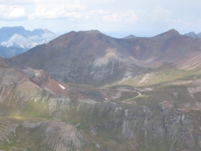
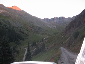
It was good to have a hot meal before heading out onto the Alpine Loop Scenic Byway. We would be driving about 18 miles northeast of Silverton to our camping spot in the American Basin. This portion of the Alpine Loop is a jeep trail suitable for four-wheel-drive vehicles only. (In this case, 4WD vehicles count as “jeeps” regardless of make. We have a Ford Expedition.) The Alpine Loop winds through the heart of the rugged but spectacular San Juan Mountains, between Silverton and Lake City. This road network linking together all of the mining camps was first used in the late 1800’s.

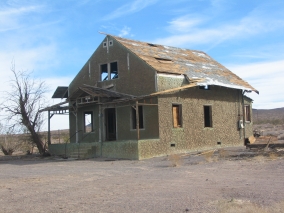
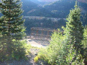
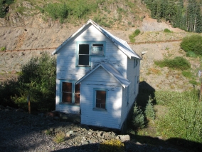
The first part of the Alpine Loop on the outskirts of town was lined with tents and trailers on both sides of the road. I never saw so many people camping in one area! It kind of reminded me of a gypsy caravan. Along the way we also passed by many old mines and dilapidated wooden structures – some of which were already collapsed and others which looked unstable to the point of being ready to fall down at any time.

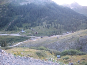
I always thought that Arizona had lots of ghost towns, but unfortunately nothing remains of most. I was surprised to see more real historic western structures still standing in the mountains of Colorado than there are in Arizona – including an entire abandoned townsite called Animas Forks! This is right near where the Animas River begins. Interestingly, its full name is El Río de las Animas Perdidas, or the River of Lost Souls. Read more about the living history of Animas Forks here: http://www.blm.gov/education/feature/1999/co/

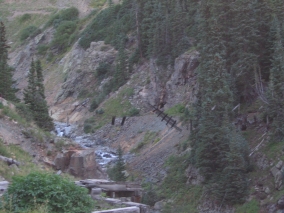
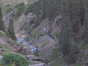
We even saw an old wooden footbridge over a ravine with the boards still dangling there, as if straight out of an Indiana Jones adventure. Sadly, we didn’t have time to stop and explore because sunset was approaching and we had to find our camping spot.

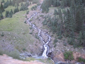
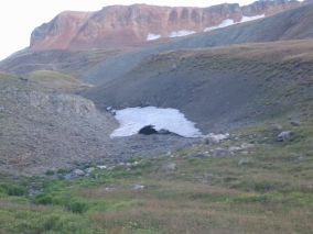
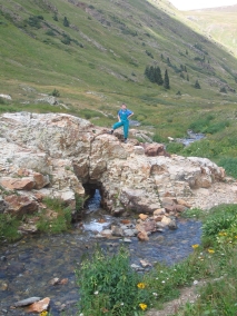
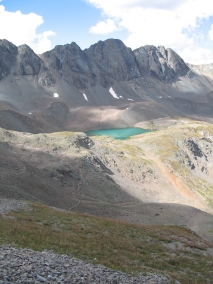
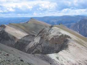
Another neat thing about Colorado was that there was water everywhere in the form of mountain streams, lakes, and waterfalls. As we rounded a bend near Cinnamon Pass, the next amazing sight we saw was snow! While in Arizona it was a hot 110 degrees, here in the high mountains of Colorado it was cold enough to have snow – even in August!

We’re used to driving on high-clearance jeep trails in our Ford Expedition. What we didn’t know was that the steep, narrow dirt roads of the Alpine Loop had suffered some serious damage as the result of heavy winter snows and summer rains. There are plenty of ruts and pretty good washouts in various places, with caution cones blocking off eroded sections along the edges of sharp dropoffs. This meant that its “hardness” rating as a 4WD road had increased significantly compared to previous descriptions we had read on the internet.

It was slow-going and scary sometimes because of the narrow steep road – there are plenty of places where you wouldn’t want to run into someone coming from the opposite direction! – but we did pretty well all the way past Cinnamon Pass at 12,640 feet. At that point, we had actually driven higher than the tallest mountain in Arizona. Then we came to a really sharp hairpin turn at a steep angle over protruding rocks with a rut in the middle. The rest of us got out of the car while Rich carefully nudged it over that spot.

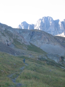
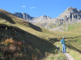
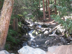
There were still people camping all along the way although the farther in we went, the less populated it was. The sun was going down when we finally found the American Basin turnoff. We set up our tent in a grassy meadow beside a gurgling mountain stream. I kept waking up at night and feeling a little queasy, but wasn't sure if it was due to the altitude (11,600 ft.) or the sound of the water making me seasick! I felt fine when I got up in the morning, though.


And no wonder there was snow up there, we were freezing that night! At least our sleeping bags kept us cozy. It was 41 degrees when we ventured out and checked the thermometer, so it may have been even colder during the wee hours of the morning.
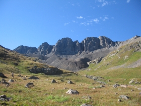
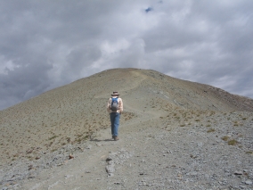
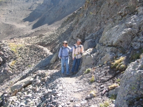
Labels: , , , ,